hiking notes
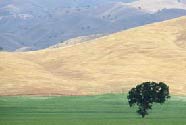
World class ocean views from coastal ridges that at times, seem about as close to heaven as you've ever been. Hilly grasslands filled with California Poppies, Lupine and Owl's Clover fill your senses. Fog creeping in, then out, creating layer upon layer of coastal hills. This is truly one of the finest escape routes I've ever taken.
Notes From Jason (verbatim):
If you have more time, for a day hike, a stroll up to the Gorge would be nice within Big Sur. Just ask the rangers where is the Gorge.
If you have say a couple of days I would suggest hiking up to Sykes Hot Springs, about 12 miles 1 way, very nice and relaxing.
Notes From Sandi
Trails tend to be steep in Big Sur and many wash out during winter storms however the rewards are exceptional. Spring hiking is filled with green and wildflowers.
Vincente
Trail
- 7.75 miles, 5 hours, 3,000 foot elevation change. Fantastic
views of the dramatic coastline and Lime Kiln Canyon make this
steady & pleasant descent from the ridge to the ocean worth
remembering. Preparation: Recommended day hike for dry
weather & road conditions. Bring plenty of water, sturdy
hiking shoes, long pants and warm clothes. Poison oak is prominent
near the trail, making long pants a good idea.
Getting There: Four wheel drive is recommended and vehicle
drop at both ends of the trail as it is a good day hike. From
Highway One 4.0 miles south of Lucia or 8.7 miles north of Gorda
at Kirk Creek, go east on Nacimiento Road. Drive about 6.5 miles
to the Nacimiento Summit and the intersection with Central Coast
Ridge Road. Turn left onto the Ridge road. This is a dirt road.
Follow the road 4 miles to the Vincente Trail Head. You may need
to look back to see the sign at the trailhead.
The Trail: The hike begins as an ascent to the top of
the ridge working through tan oak and madrone forest but soon
turns into redwood forest as it descends along the ravine. In
spring you will see a rushing creek with waterfalls and some
log crossings. Two miles from the trail head you arrive in Vincente
Flat a meadow campground among redwoods. The redwoods along the
trail were scorched in the 1985 fire but are still growing thanks
to their fire retardant bark. The trail works across hillside
meadows filled with lupine, iris, poppies in spring and chapparral
throughout the year. We saw over 30 species of wildflowers on
our April 24th hike. Through the trees the trail steadily descends
at a pleasant grade about 3,000 feet in total giving half open
vistas and half forest cover and a good workout. Five miles from
Vicente Flat you will come to Highway One at the Kirk Creek Campground.
(hiked 4/24/99 11:30 am - 3:30 pm with Peter, JC, Barb &
Ed)
Notes: Help keep the trail in good condition by staying
on it and not cutting the switch backs.
Cone
Peak Trail
-
4 miles round trip, 1,155 elevation change from trail head to
peak. Fantastic views from 5,155 ft. Cone Peak
Preparation: Recommended day hike for dry weather &
road conditions. Bring water, sturdy hiking shoes, long pants
and warm clothes. Poison oak is prominent near the trail, making
long pants a good idea. Map: Los Padres National Forest Ventana
& Silver Peak Wilderness Areas, Monterey Ranger District,
California available through the Ventana Chapter of the Sierra
Club (831) 624-8032.
Getting There: Four wheel drive is recommended and vehicle
drop at both ends of the trail as it is a good day hike. From
Highway One 4.0 miles south of Lucia or 8.7 miles north of Gorda
at Kirk Creek, go east on Nacimiento Road. Drive about 6.5 miles
to the Nacimiento Summit and the intersection with Central Coast
Ridge Road. Turn left onto the Ridge road. This is a dirt road.
Follow the road 4 miles to the Cone Peak Trail Head. (This access
road is also the starting point for the San Antonio Trail going
east into the Ventana Wilderness and the North Coast Ridge Trail
going north on the ridge).
These trail descriptions are from the Trail Guide to Los Padres National Forest- Northern Section:
Pine Ridge Trail One of the most popular portals to the Ventana Wilderness - (Big Sur to China Camp- via Sykes Hot Springs) From the Big Sur Forst Service Station parking lot just off Hwy one south of the State Park entrance, stay on the main trail. 4.3 miles to Ventana Camp, 5.5 miles to Terrace Creek Trail, 6.7 miles to Logwood Creek, 6.9 miles to Barlow Flat Camp (good place to spend the night, if you are going in Friday), 9.8 miles to Sykes Camp and hot springs. The hot springs have been improved and there are 3 good springs at the camp. You can continue for the entire 23 mile loop or just enjoy the hot springs and the countryside for a weekend trek by returning the way you came.Be prepared for primitive camping.
Ventana Double Cone 29 miles, starts at Bottcher's Gap Campground at the eastern end of Palo Colorado Trail.
Salmon Creek Trail 11.4 miles round trip to Coast Ridge and back. starts on the east side of the highway on the south side of the stream. The trail gains 100 feet in elevation then becomes more level and follows a contour along the south slope of the canyon, sometimes in woods, sometimes on open slope covered by a profusion of wildflowers in the spring. There are spacious views down the canyon to the ocean. There are two camp spots along the trail at Spruce Creek & Estrella Creek. A strenouous but spectacular loop trip can be made from the Cruikshank Trail to the Coast Ridge and back to Hwy 1 via Salmon Creek Trail. The total distance is 12.7 miles and a car shuttle can eliminate 4 miles of highway walking.
Lime Kiln Trail - 1.8 miles, 1 hr - hike to a gorgeaous redwood forest and the lime kilns used to make limestone bricks and cement in the 1880's. The highlight is the 100' Limekiln Falls that drop over a limestone face. Found on an unmarked spur trail immediately after the second bridge. ( The first bridge is near the campground.) Some boulder hopping required to get to the falls.
Hunting & Fishing Information: California Department of Fish & Game - (831) 649-2870.
.Pick up a topo map for more detail.
All activities in life can be potentially dangerous, if you choose to do the activities on we talk about on this web site, please be careful & responsible for yourself and concious of the environment and wildland habitats.